The DoKterrain Project
(Note that neither of us have touched this in years. It was a concept that got part way done before life got kind of complex for me.)
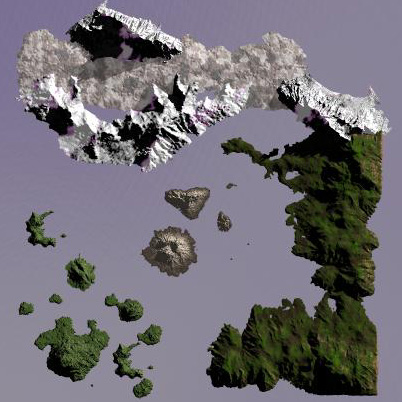
Below is a mock-up of a 3-country terrain I want to build. I constructed this prototype in Bryce and now have to convert it to a height map, then start learning the AH Terrain Editor. I’ve also listed the interesting points of this design below. The general idea is to create a map which fosters more realistic operations, and creates more of a feel of invading another country than just crossing some imaginary border.
NUTTZ built the prototype of this terrain, its awesome work!
-
Provide buffer space between the 3 countries so that local air superiority is needed to first gain a foothold on the enemy soil. This will hopefully foster a little more coordination and mission creation. It’ll also allow players facing each front to decide if they’re on “offense” or “defense” a little easier.
-
Provide geographic boundaries between the 3 countries so that an air assault MUST be the first step. Same reason as above - it’s also too easy to use GV’s now. Fleets can play an obviously important role here - right now they’re kind of useless.
-
Have a central sea for fleet operations - without having it look like one big crater lake. And, with fleets becoming more important in the early phase of an offensive, maybe PT boats will start to see more action.
-
Create the equivalent of “Pearl Harbor” in this sea. It will have 2-3 air bases plus a port. Holding this gives a side an obvious advantage. This also provides a “3rd front” to allow a side that’s too weak to stage a large scale assault on an enemy homeland something to do besides get stomped.
-
Have each landmass look different - so that there’s the real feeling of “invading a country.” The Northern landmass is snowy mountains and steppes (sort of Norway-Finland - and central Russia), the East is continental European, and the South-West is islands (sort of like the Solomons). The central atoll is volcanic … like Hawaii.
-
Make the terrain interesting in general. I plan to hide HQ’s, factories, etc. in interesting places - to create flak traps and cool NOE strike opportunities below radar - or hidden by terrain. Fighting in mountains is great fun too - if you ain’t a pile-it, anyway. I want to put something very close to an “underground” base on that central atoll. Basically a single runway fighter strip jammed in a steep gorge, ringed with light flak - only way to kill it is heavy bombers on exactly the right headings - JABO’s would get eaten up quick until AAA is down. The big base there will be in the volcano crater (of course).
In keeping with each country’s different motif, each land mass also has different strengths and weakness in terrain. The North is protected by mountains, but that makes it also harder to launch outbound - the flatness of their steppes also means a land assault can really get rolling against them. The East is wide open to attack, except it has the highest elevation HQ and main bases - meaning it can launch heavy bombers better, and protect against them as well (bombers at 25K aren’t as safe when the defending fighter base is at 15K). The SouthWest is vulnerable to sea attack, but because of the island configuration, land assaults won’t work until they’re forced back to the “big island” (only one field per smaller island) - so attacking them will require sustained air assaults with no “cheating” with Osties.
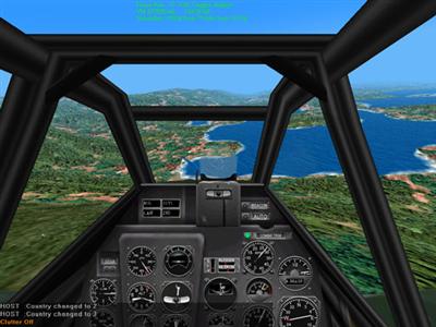
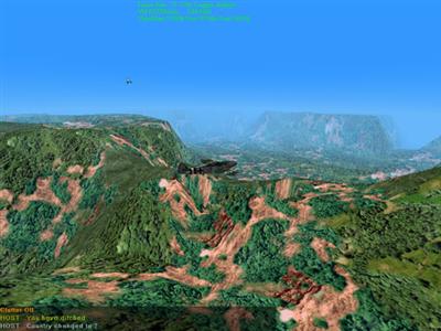
Sceenshots taken 26.Mar.01
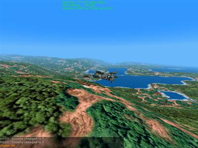
One of the inland lakes in the North (in summer).
Diving toward the inland lake from the mountains.
A view of the inside of the volcano.
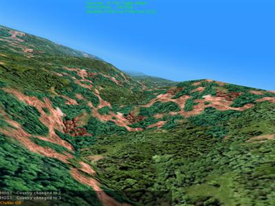
You want rolling hills? We got rolling hills.
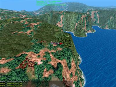
Another of the inland lakes in the North. That’s a 15,000 ft drop.
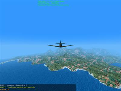 Approaching volcano island.
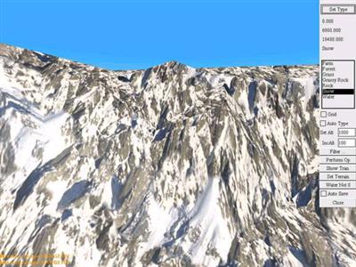
NUTTZ’s new winter/mountain terrain texture.